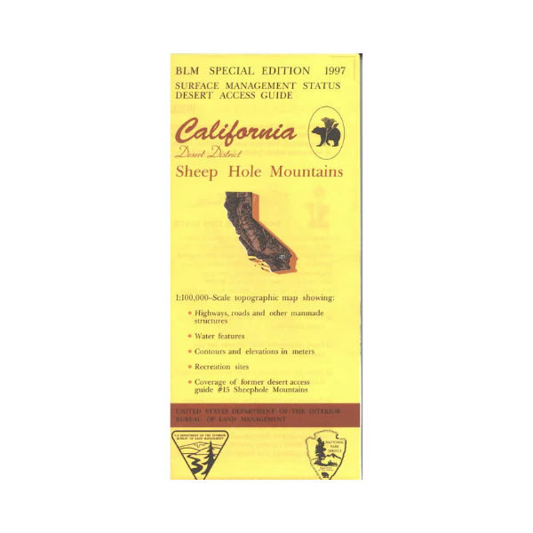
Map: Sheep Hole Mountains CA - CA485S
Map shows expansive BLM lands east of Twenty Nine Palms and a small section of Joshua Tree National Park. Backside of map has extensive information about the designated 25 million acre California Desert Conservation Area. Includes descriptive information about the places on the map, along with available recreational activities such as camping, hiking, horseback riding, and 4 Wheel/OHV driving. Official Bureau of Land Management metric topographic map @1:100,000 scale (roughly 3/4"=1 mile), color-coded to show surface management, i.e. agency vs. private or tribal ownership. Map shows roads, water features, recreation sites, points of interest, and the township and range lines. Map shows trails and developed recreation areas such as campgrounds. Use this map for Deer Hunting in Units D12 and D17. 1997
Original: $8.99
-65%$8.99
$3.15More Images
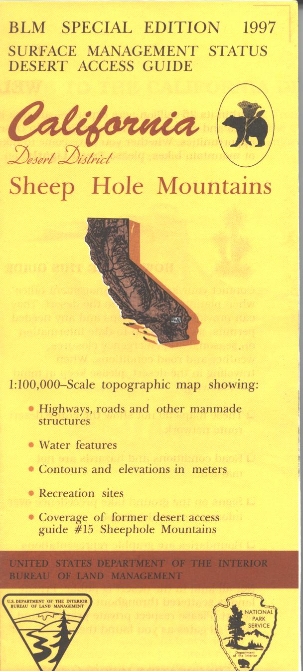
Map: Sheep Hole Mountains CA - CA485S
Map shows expansive BLM lands east of Twenty Nine Palms and a small section of Joshua Tree National Park. Backside of map has extensive information about the designated 25 million acre California Desert Conservation Area. Includes descriptive information about the places on the map, along with available recreational activities such as camping, hiking, horseback riding, and 4 Wheel/OHV driving. Official Bureau of Land Management metric topographic map @1:100,000 scale (roughly 3/4"=1 mile), color-coded to show surface management, i.e. agency vs. private or tribal ownership. Map shows roads, water features, recreation sites, points of interest, and the township and range lines. Map shows trails and developed recreation areas such as campgrounds. Use this map for Deer Hunting in Units D12 and D17. 1997
Product Information
Product Information
Shipping & Returns
Shipping & Returns
Description
Map shows expansive BLM lands east of Twenty Nine Palms and a small section of Joshua Tree National Park. Backside of map has extensive information about the designated 25 million acre California Desert Conservation Area. Includes descriptive information about the places on the map, along with available recreational activities such as camping, hiking, horseback riding, and 4 Wheel/OHV driving. Official Bureau of Land Management metric topographic map @1:100,000 scale (roughly 3/4"=1 mile), color-coded to show surface management, i.e. agency vs. private or tribal ownership. Map shows roads, water features, recreation sites, points of interest, and the township and range lines. Map shows trails and developed recreation areas such as campgrounds. Use this map for Deer Hunting in Units D12 and D17. 1997


